

Since 2022, Lincoln Aerial Mapping has been dedicated to providing professional aerial mapping services to a diverse clientele, including engineers, architects, landscape architects, developers, private landowners, real estate attorneys and agents, contractors, government agencies, utility companies and other design professionals.
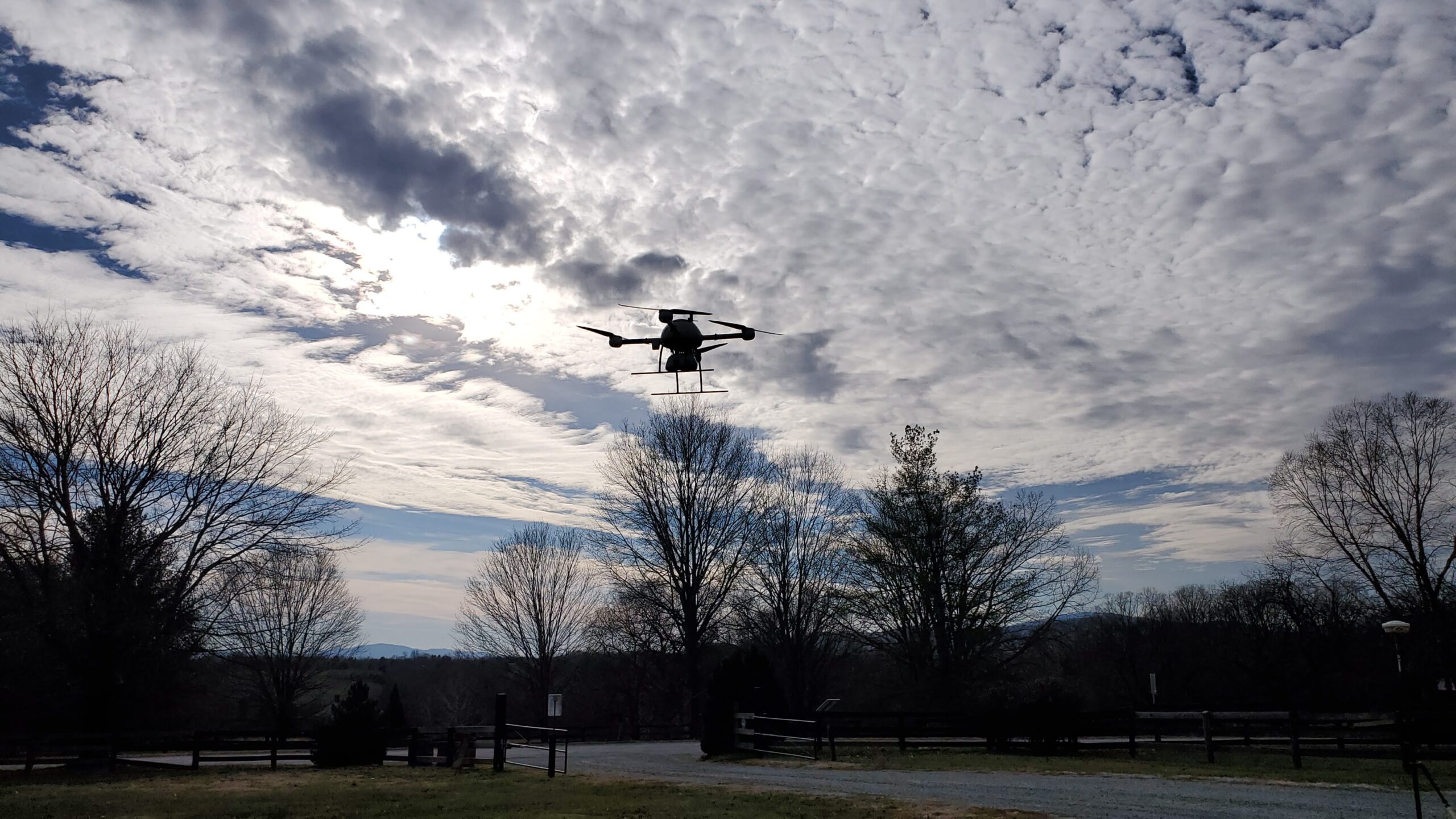
To reach this goal we have assembled an experienced team of field and office technicians and paired them with the latest LiDAR enabled drone equipment and technology.
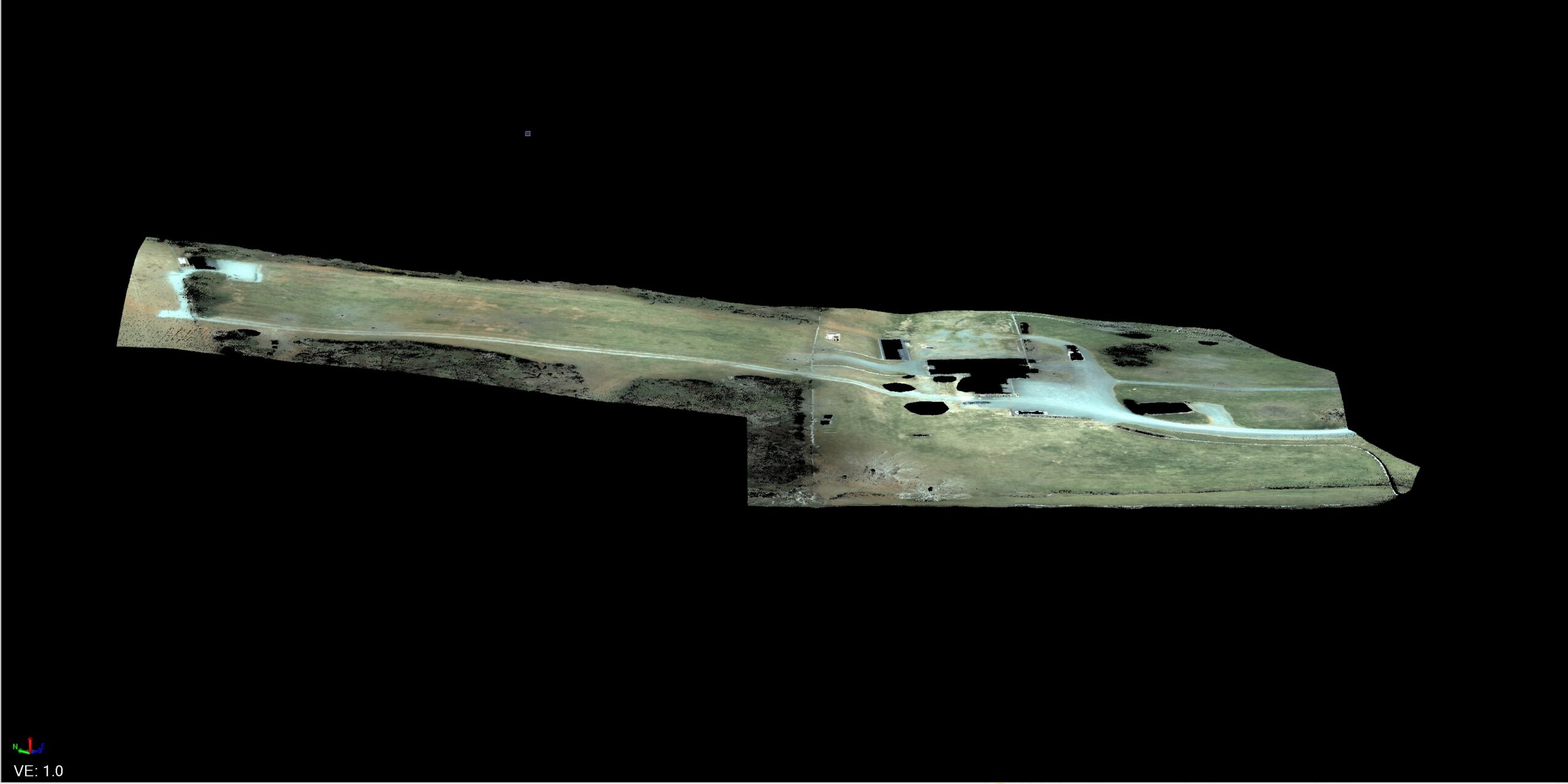
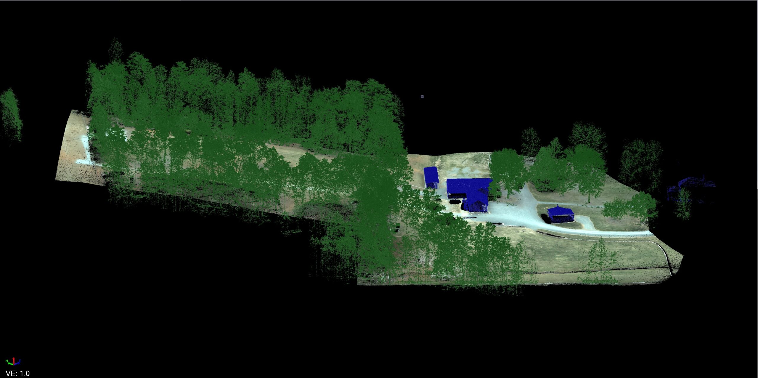
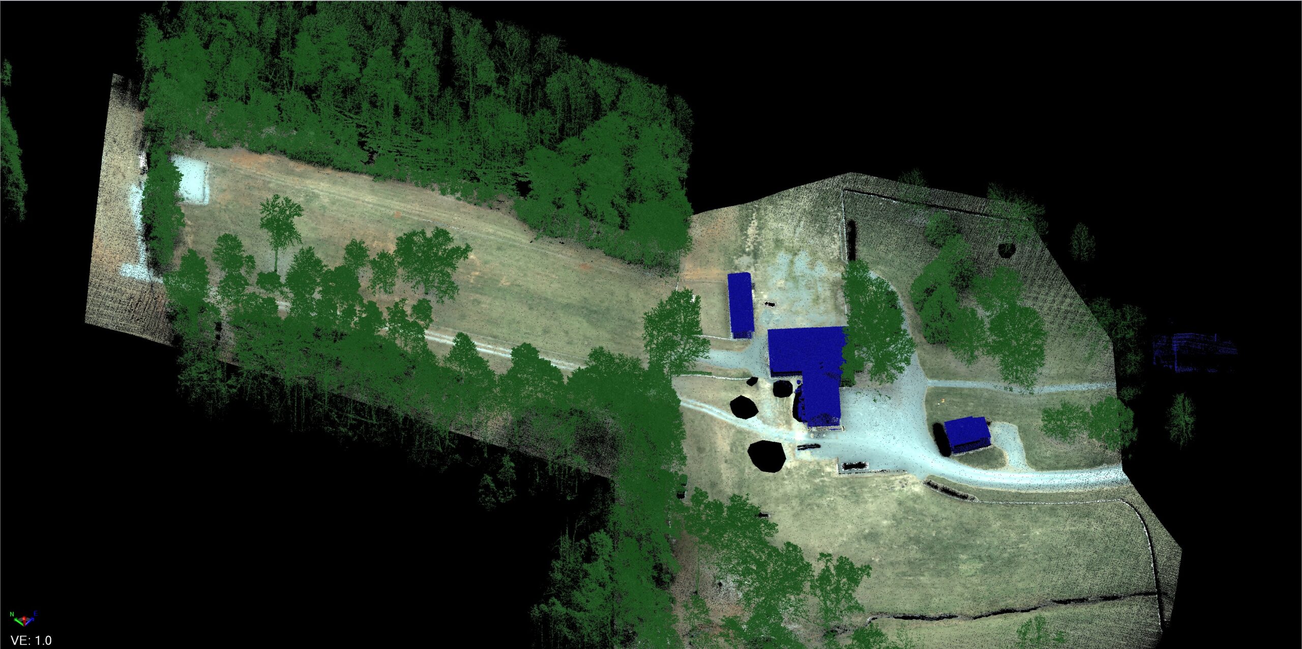
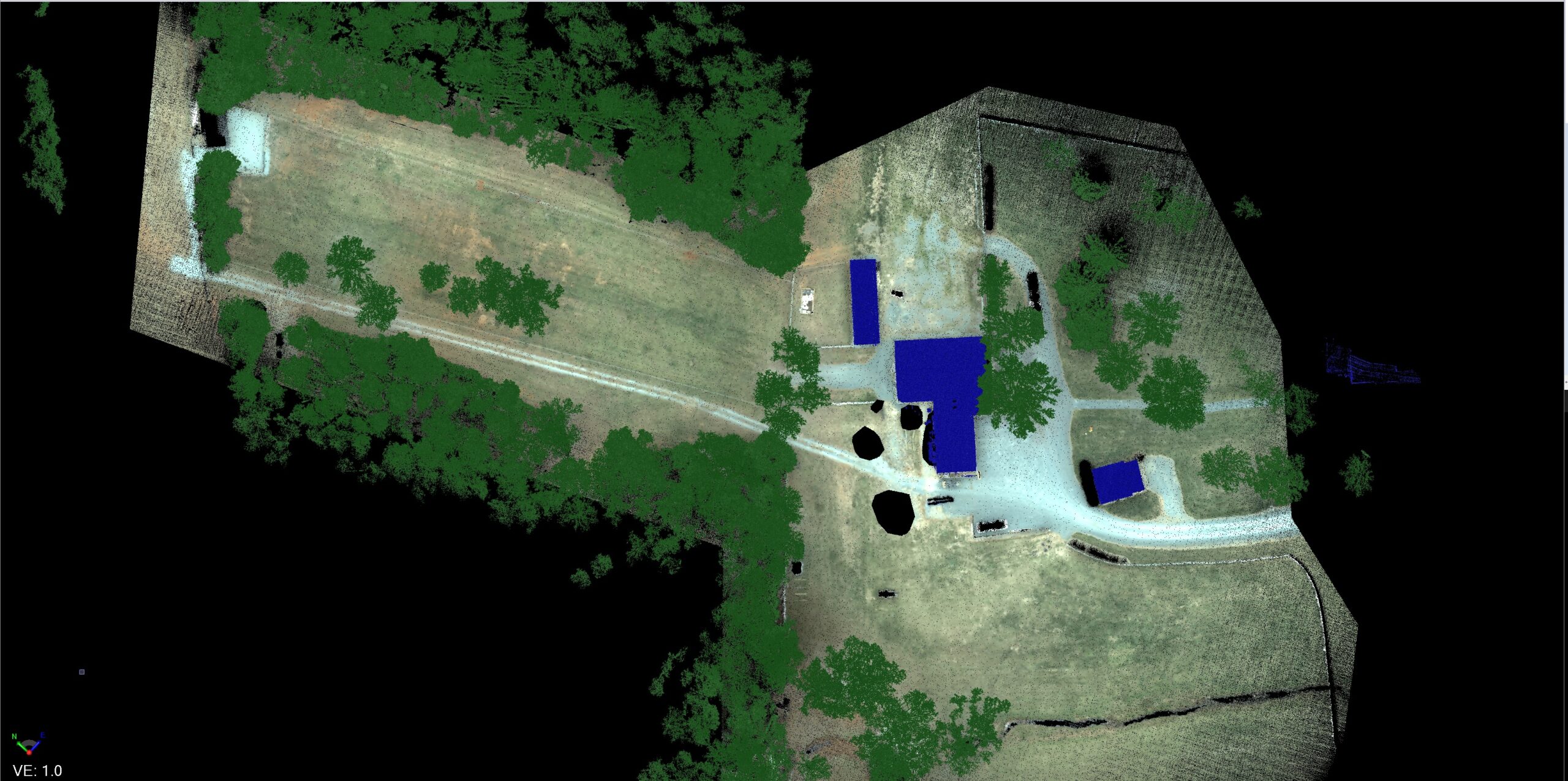
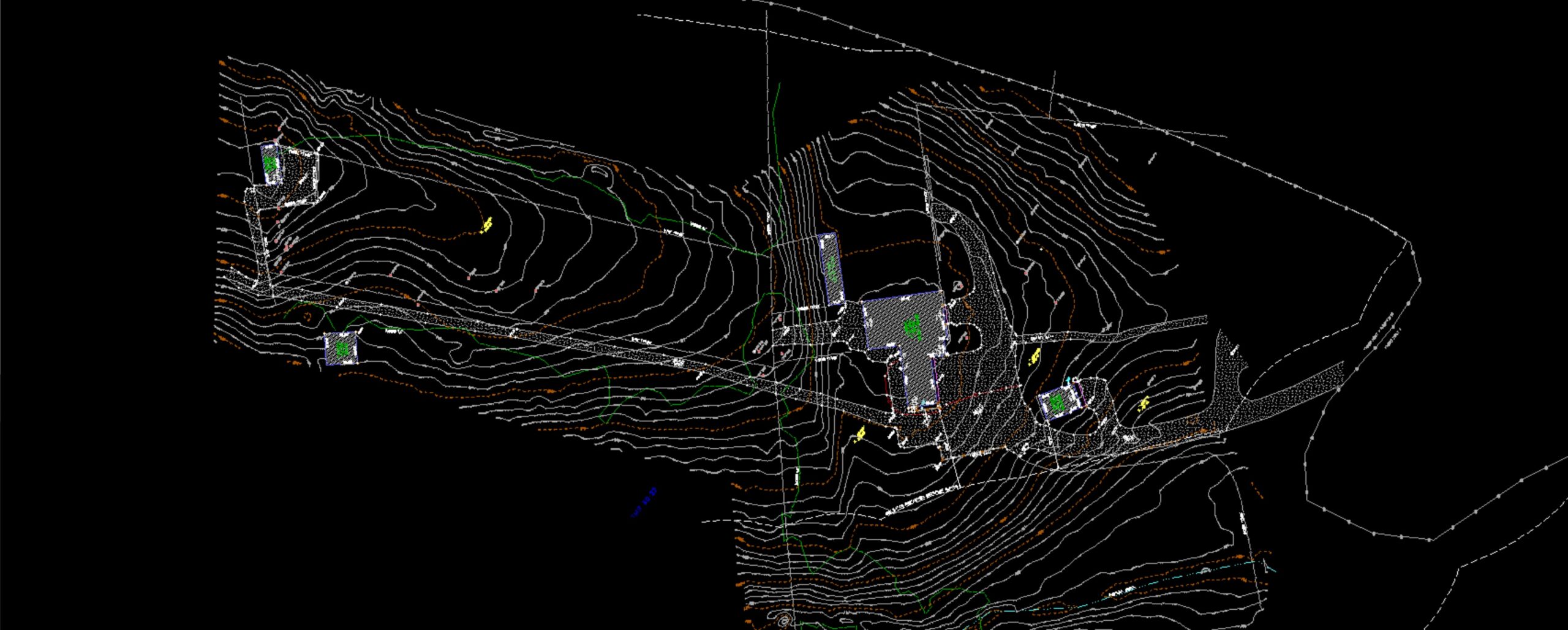
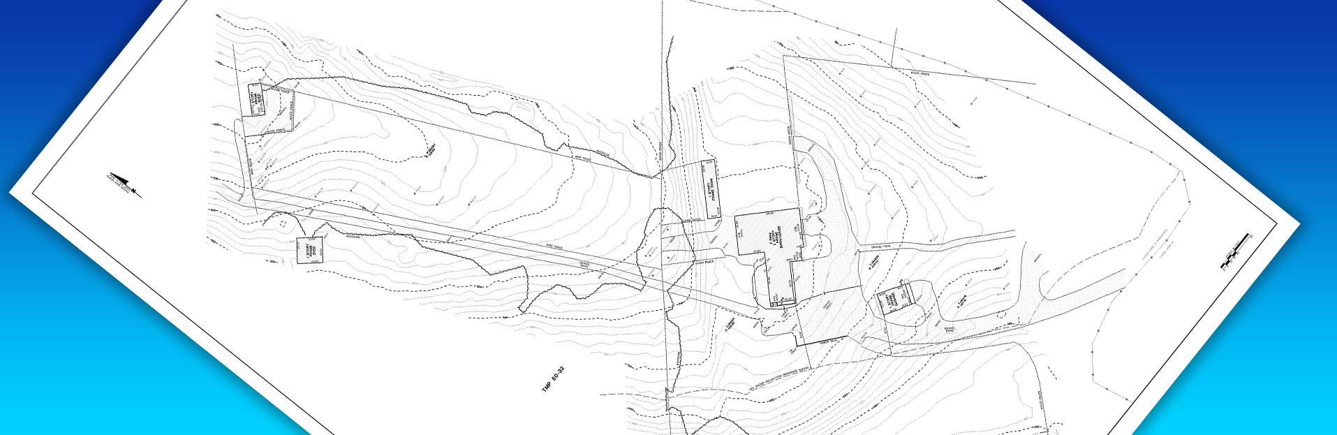
LiDAR Aerial Mapping Services
- Topographic Surveys
- Route Surveys
- Tree Canopy Surveys
- As-built Surveys
- Grading Performance Certification
Deliverables – Land Surveyor Certified:
- DWG
- Point Cloud
- Imagery / TIF
Get in touch to learn how we can increase reliability of your results while saving you time.

For more info on aerial mapping in Virginia… victoria.kean@lincolnsurveying.com